Friday, May 21, 2010

Cerro Alto Campground

Cerro Alto Campground is within Los Padres National Forest and is only about 8 miles from Morro Bay. On May 15 it was a 16 mile one-way ride from my home in Los Osos, with a moderate hill for the last couple of miles on Highway 41 before the turnoff to the campground. As is evident from my blog, I have birded at this location on many occasions. It is an excellent place for migration and it is good for breeding species. It is a great place to study bird song April through July!

On this particular trip I was pedalling to Cerro Alto to look for unusual migrants and to look for Black-chinned Sparrow, a local breeder that I had not yet seen for the year. As I was locking up my bike near the beginning of the entrance road at about 8:15, MacGillivray's Warbler was singing from a nearby oak and Warbling Vireo and Black-headed Grosbeak sang from the close by creek side riparian willows. It was hard to unpack, change clothes for hiking and lock up the bike when I was surrounded by various bird songs and calls that demanded attention for a student of birds and their vocalizations. After many interruptions, I finally got changed into hiking shorts and shoes I had brought, and put my pannier in a day pack with my lunch and anything else I did not want to leave with my bike.

As always, I walked the entire entrance road and up the trail past the end of the campground to check for migrants. There still were interesting migrants such as Hermit and Townsend's Warblers as well as the local breeders of interest such as Olive-sided Flycatcher and Western Wood Pewee. By the time I finished birding along the creek it was almost 10:00 and I hurried up the trail which climbs west out of the campground so I could look for Black-chinned before it got any later.

As I took the trail up out of the canyon, I passed a variety of blossoming wildflowers. The trail started in the shade of oaks and other trees, but gradually had fewer and fewer trees as I climbed up to the ridge top. I passed a Velvet Ant as I hiked. Not really an ant, it is a wasp and the female pictured is wingless. I've never seen a male, as far as I know.


Among the flowering plants was the yucca, with its beautiful spike of cream colored flowers. I must admit that I am not a fan of the cooked yucca root, at least as I have had it prepared for me in Central and South America. The flowers, however, are beautiful.


As I climbed over the top of the ridge I descended a short distance to a "T" where the trail met the trail coming down from Cuesta Ridge. The chaparral here had burned a few years ago and it looked good for Black-chinned. I played a recording since I thought it was getting late in the day for their song. Blue-gray Gnatcatchers and Bell's Sage Sparrows called and sang around me. I heard no Black-chinned so I took the trail toward the eucalyptus grove. After less than a quarter mile I heard a Black-chinned song (BIGBY # 271). I played the recording and heard a couple of others. One came close, but stayed in cover or too far away to photograph. A little further down the trail and a black-chinned sang right next to the trail. I managed to get the photo here. Another sang on the other side of the eucalyptus grove along with a couple of Rufous-crowned Sparrows.


As I hiked past the last of the Black-chinneds, I saw some movement of hairy legs go down a hole in the ground - slightly smaller than a gopher hole. It was the hole of a tarantula, but the spider would not come back to the opening as long as I stood there. If it had come out, I am not sure if I would have tried to pick it up. I had held them before, but I didn't know if that was wise when they are at their hole. I took a photo of the hole with a key for scale before finishing the hike back to my bike and then the ride home.

Thursday, May 20, 2010

Birding In the Local Patch

My local patch, that I regularly bird, includes not only my immediate neighborhood that I cover almost every morning with my dog, Nike, but also Montana de Oro State park and Los Osos. This includes adjoining areas within 4 or 5 miles (15 minute bike ride) from my house. Two days after I got back from my Kern County trip, I walked the dog around the nearby back bay and was back on my bike to Montana de Oro. (I try to get out as often as possible in May and June to cover as many good areas near the coast as possible - primarily listening for out-of-place calls or songs.) At the end of my street, in a place called Pecho Willows, I had my second Black-and-white Warbler (below) of the year. It was a female and stayed for 2 days in the same group of willows. (I guess there is no way to trade this sighting with another BIGBY birder for a species I haven't seen this year?)


At Montana de Oro I had this Gabb's Checkerspot butterfly (below) at Coon Creek, but no unusual birds there or at the campground. Both places were pretty quiet on this particular morning.

Sunday, May 16, 2010

Kern Refuge and Home - Days 9 & 10

May 5 was going to be a long day of birding and cycling - over 100 miles of riding. It was a chance for 3-6 new BIGBY birds at the Kern National Wildlife Refuge, a place I had birded years ago when I lived and taught in the closest town to the north, Corcoran.


I left the Cinderella Motel in Wasco at 6 AM, but by the time I stopped for a fresh made turkey and Swiss cheese deli sandwich at a nearby market, it was closer to 6:30 when I left Wasco for the refuge. I travelled the flat 26 miles to the refuge at a decent clip and arrived at 8:15. Just before getting to the entrance, I got the juices flowing when I spotted several flocks of White-faced Ibis (BIGBY #267) flying over the road from the refuge. (I had fun copying their nasal call as I pedalled by them at the refuge, where they were common breeders.) After the entrance, I immediately took the gravel road (the 7 mile self-guided auto tour route) around the refuge. My 28 mm. tires were narrow for this road, but they held up despite the rocks.


This over 10,000 acre refuge was a combination of open shallow ponds, thick tule marsh, occasional cottonwoods and willows, and dry areas that were either dried up ponds from the winter or permanently dry uplands. It was fairly quiet for land birds except for the Tricolored, Red-winged and Yellow-headed Blackbirds (BIGBY # 268), which were numerous and a few Marsh Wrens and Western Kingbirds. Shorebirds in the open ponds included American Avocet, Long-billed Dowitchers, Least Sandpipers and Black-necked Stilts (BIGBY # 269). A couple of stilts were on nests (photo below) that consisted of a pile of vegetation out in the open, surrounded by water. Ducks included Gadwall, Mallard, Ruddy Duck and Redhead (BIGBY # 270), which were fairly common. I really searched the cattail edges for bittern and moorhen. I surprised an adult Common Moorhen (BIGBY # 270) which was feeding out in the open as I came out from behind some tules. It ran back for cover across some floating vegetation, but I had a decent look. I found no bitterns before I had to leave at 10:00 AM. The refuge office was still locked, but I had a long ride ahead.


From the refuge I did a lot of cycling and very little birding till McKittrick. The back roads I took were quiet farm roads and I made good time till just before McKittrick. I stopped at about 1 PM in the middle of nowhere to eat the lunch I had packed, with the only shade being a large tamarisk (it took several miles to find any shade). Unfortunately, people had used the turnout and the tree to dump trash (including a dead coyote) and to break glass. Under the tree it was much cooler and a pair of Western Kingbirds were nesting above me. It felt good to take of my shoes and socks, and relax during my lunch break!

About thirty minutes of cycling after my lunch stop, the road began to climb as I was starting up the base of the Temblor Range, an arid range that separates Kern from San Luis Obispo County. After a few miles of climbing, I arrived at the small drab town of McKittrick. I was hot, tired and thirsty. I used my last water (and electrolyte drink) as I neared the town on Highway 58. I cooled down with a couple of frozen push-ups and bought two large bottles of water to refill my water bottle and mix some electrolyte drink. I decided to bring an extra bottle in my pannier as well. (I ended up drinking over a gallon of fluid that day on the road!)
The road climbed over 2,000 feet to the summit of the Temblors. I found, however, that as I climbed my surroundings began to get more vegetated and the desert gave way to dry pasture land. The fields started to be greener and wildflowers dotted the roadside. A little higher and the breeze came up. The transformation in weather and plant life from below McKittrick to the the summit of the Temblors was amazing. The views back to the valley were a little depressing, however, as the haze/smog limited the visibility to a very short distance across the valley.


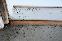
After clearing the summit, I thought I would just descend to the Carrizo Plain and then take the flat Soda Lake Road to the California Valley Lodge (left). I had forgotten the roller coaster like road that is located between the descent west from the summit and the flat Carrizo Plain. I was tired from the day's ride and did not have any patience for the up and down of this portion of Highway 58. Eventually, I cleared the last of the surprisingly many little uphill climbs and dropped to the plain before turning onto the Soda Lake Road and the last couple of flat miles to the motel. Owner, Kenneth greeted me and said my mailed food was in the same room I used before. The beetle invasion (below) was still going on as they piled up next to walls and doors of the motel. I felt tired from the long ride but not exhausted. I unloaded, washed a jersey and shorts, birded a little, ate my microwaved food for dinner and repacked for the next day's return home before writing in my journal and calling it a day. This motel room had no TV or other entertainment so there was really nothing more to do anyway.


On Thursday, May 6, I got up when I woke up and prepared for my last leg of the journey. Other than a possible Black-chinned Sparrow, any new BIGBY birds were unlikely for the day. The ride through that end of the plain did go past a farm pond that had a lonely looking female Bufflehead, a flock of Tricolored Blackbirds and some Yellow-headed Blackbirds (new for my county year green list). I also watched an adult Golden Eagle being harassed by a Western Kingbird that repeatedly dove on it while the eagle sat on the utility pole and then chased the eagle as it flew off.


The climb out of the plain was a very short one and then I began the up and down road between there and Santa Margarita. I had to remind myself that every uphill had a downhill after it rather than the opposite (the glass half full rather than half empty approach). I remembered much of the ride from here on. I stopped at San Juan Creek and other spots along the road that looked birdy, but found nothing unusual. I heard one Phainopepla, which was less than my ride back in February. I stopped in areas of scrub brush hillsides that looked appropriate for Black-chinned Sparrow, but could find none, even with the aid of a playback of a recording of their song. I was in no hurry to end the trip so I took my time. Hillsides of flowers brightened the day's ride.


I arrived at Santa Margarita after a pleasant 50 mile ride, with a fair amount of hill climbs, but nothing too tiring. I stopped at the restaurant named "the Porch" and knew that I was back in a coastal county as I ate my grilled portabella mushroom sandwich (not big in Kern County) and air popped chips.


After leaving Santa Margarita, I rode for a short distance on the very busy and noisy Highway 101 before getting off on Old Stagecoach Road which was dirt, but much more pleasant with the sound of cars replaced by the sound of a stream and the hot sun by the shade of the many trees lining the road. I found a large gopher snake and a king snake on the road. Another short stretch on Highway 101 and then through San Luis Obispo to Los Osos Valley Road, which had its usual spring afternoon onshore headwind. This was the third leg of my trip that finished with a strong headwind, but it seemed only a minor annoyance compared the wind at Lake Isabella. It didn't dampen my enthusiasm for returning to my home and my own bed for a good night's sleep, as well as a couple of days to rest after my ten day trip. The trip was definitely worth it - for the thirty new species of birds, for the mostly very pleasant cycling, for the challenges of some days and the beauty of others, and to have a whole different (and more intimate) feel for travelling across our extremely varied state.

Lost in Bakersfield - Day 8

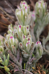
I purposely got a relatively late start on day eight because I wanted to avoid commuter traffic from Lake Isabella to Bakersfield. By the time I left my motel room and stopped for some sun screen and some Vaseline (I was a little raw from my bike seat), I didn't leave Lake Isabella till after 8:00. I went to Bodfish and caught Kern Canyon Road for the first 13 1/2 miles of the canyon. There was not even one car on Kern Canyon Road and the slopes were green. There were bunches of wildflowers including these "Grass Nuts" pictured, a type of Brodiaea.(What is it about brodiaeas - the one on the coast is "Blue Dicks"?) Bird song included Lazuli Buntings, Phainopeplas and MacGillivray's Warblers. I had not realized that there would be a good number of uphills as well as the predominate downhill slopes; it took me till about 9:30 to reach the end of the old road and the return to Highway 178 .


So many people had warned me about this part of Highway 178 through the narrow canyon, that even though I had come up it, I still was a little fearful and had not slept well the night before. This stretch was consistently downhill and I kept my speed down and used turnouts (there were many) whenever I heard traffic behind me. Just before the end of the canyon, a truck with a wide load came up to me from behind and followed right behind me until I got to a place where I could get off the road and it could safely pass (barely). After less than 15 miles of the narrow canyon portion of 178, I emerged at the end of the canyon and stopped to look at a waterfall created by piped water from the river. A Caltrans worker stopped nearby told me that I was braver than he was to ride the canyon. I thought to myself, "or stupider".

But I was out of the canyon and there was now a paved shoulder for bikes to safely ride. I could relax a little and make my way to Lake Ming and the start of a thirty mile bike path. I stopped near Lake Ming, at a gas station market (my usual gourmet lunch stop), and got a sandwich and orange juice for lunch and a carton of Chocolate milk for immediate consumption. The bike path start was not well signed, but I found it since friends had told me where to pick it up. I looked for Common Moorhen reported from the east side of the lake, but instead found Green Heron at the edge of the reeds on floating vegetation. Yellow-breasted Chat sang it's varied song of whistles, chucks, and other sounds from the undergrowth along the Kern River Channel on the north side of the lake, as the bike path ran along the northern shore of the lake.
I had lunch at a picnic table, in the shade of trees, in Hart Park (just west of Lake Ming), but lost the bike path before I left the park. I could not find the path no matter how hard I tried. It had apparently joined the street in the park, but where it became a path again or where I was suppose to go to rejoin it was totally unclear. After searching for awhile I gave up. The path did not seem to have been worth the trouble - it was not well maintained and did not have many good views of the river for seeing birds when I was on it.

So, I checked the map I kept in my handlebar bag and determined how to get to the shortest way to Wasco, the ultimate destination for the day. I took the "scenic" route through Oildale, which took me through the Kern River Oil Field. This was appropriate for my green birding trip as it showed what happened to areas where oil is produced. It was a wasteland - like the surface of the moon with the addition oil wells, pipes, utility wires and trucks. And the smell! My photo does not adequately portray the devastation!


After heading west from Oildale I turned north and looked for "Seventh Standard", a main road which goes west from Bakersfield. I could not find it and I kept coming back to "Merle Haggard Road" no matter what I tried and no matter how much I checked the map. I finally found someone working at the side of the road, in this undeveloped area, to ask. They told me that this portion of Seventh Standard had been renamed Merle Haggard. The map I had just purchased at Lake Isabella did not reflect the change. He told me that it messes up a lot of people driving through the area. Since I am not a fan of most Country and Western music, perhaps it it was poetic justice that Merle Haggard caused me to pedal an extra four or five miles.

Ongoing construction on this road obliterated the bike lane so I had to find an alternate road. I took a back road through almond and pistachio orchards which had no traffic. It was a real improvement and eventually I turned off on Highway 46 to Wasco. I checked into the slightly run down, but mostly clean "Cinderella Motel" (where was Cinderella when we needed her?), showered, ate and shopped nearby, and washed some clothes before sleeping off my frustrating but not too physically challenging 75 mile day. Tomorrow's ride would be much more challenging.

Thursday, May 13, 2010

Into the Greenhorns - Day 7


This ten day bicycle-birding trip was way beyond anything I had done in the past. For example, I had never done a trip of over three days or over 200 miles before. On May 3, I got up to face the longest steepest climb I had ever pedalled on my bicycle - my first single climb of over 3,000 feet in elevation gain. I was set to cycle from just over 2,600 feet at Wofford Heights to over 6,000 feet at the summit of Highway 155, in just seven miles!  There were posted grades of 13%. I had driven it in the past and had shifted to my lowest gear to avoid burning my brakes on the way down. Locals shook their heads when I told them I intended to cycle up to the summit at Alta Sierra. They lumped it together with the ride up to the lake from Bakersfield - sane people didn't ride their bikes on either road.


I got a good night's sleep and got up early for the climb since I was feeling a little intimidated not only about the amount of climb, but the short distance in which it was to be accomplished. I ate breakfast in my room and packed a range of clothes since the forecast was 80's at the lake, but there was snow on the ground where I was to be birding near the summit. I decided I would take my time and bird along the way as I climbed from the town of Wofford Heights, up through oak woodland, chaparral, and eventually into the conifers of the higher mountains.

Half-awake high school students were walking down the hill at 7 AM, as I was starting up the first less steep stretch. After I got through the cluster of homes the real climb began. As I pedalled uphill I could hear the "wacka, wacka" of Acorn Woodpeckers and the robin like song of the Black-headed Grosbeak urging me on. Pedalling uphill is great for listening to birds. (Downhill, however is not, with the air rushing through the helmet and by my ears - drowning out most vocalizations.)

Less than half way up I heard a Pygmy Owl whistle in the riparian woods in the canyon below me, along with other birds I had not heard in the prior three days around Lake Isabella such as Hutton's Vireo and Wrentit. My target species on the way up was Green-tailed Towhee which I was told could be found in the chaparral where the power lines cross the highway. After 4 locations that fit the description and no Green-taileds, I stopped playing the recording and concentrated on getting to the top. I had brief excitement from the song of Fox Sparrows (song sounds a lot like Green-tailed, to my ear) and saw several Nashville and MacGillivray's Warblers. I passed the 4,000 foot sign feeling fine and about the time I felt like I would never see the 5,000 foot sign I got to the top, at just over 6,000 feet. I had taken so much time, about 2 hours, that I was not really very tired from the climb. In the conifers on the way up I had heard calls and rattles of White-headed Woodpeckers, the "chickadee-dee-dee" of the Mountain Chickadee and the nasal "ank" of the Red-breasted Nuthatch (BIGBY ## 259, 260 and 261). Some Caltrans workers were talking at their vehicles by the pictured sign near the top when I arrived. One came over to say "Hi" and gave me info on the local roads.


I took the dirt forest service road that went north from the summit, toward Tiger Flat. It was closed due to snow, but I could pedal in for a ways before the snow covered the road. This was a great bird stop. Two of the first birds I saw were male and female Pileated Woodpeckers (BIGBY # 262)! I had not seen these in Kern County before and I had not expected them on my trip. They were very shy and I could not manage a photo, but I did take a picture of a hole they were working in a tree stump (above). In that same general area were Hermit Warbler, Purple and Cassin's Finch (BIGBY # 263), Brown Creeper, White-headed Woodpecker, Mountain Chickadee, Band-tailed Pigeon, Golden-crowned Kinglet, and Yellow-rumped Warbler. After I came to big area of snow, I turned around and took the paved road south toward Shirley Meadows.


The road to Shirley Meadows was a very quiet and an easy uphill climb to the Alta Sierra Ski Resort at 7,000 feet. I passed large areas of snow in shaded areas in the trees with completely snow free slopes across the road in the sun. In one of the open sunny areas I heard a Green-tailed Towhee (left) (BIGBY # 264) call in some bushes near an overlook that looked down on area Highway 155 climbs through and the lake far below. I sat on a sun warmed granite boulder and ate some snacks and photographed the towhee. As I sat there enjoying things, a raptor went right over my head and toward the ridge on the other side of the highway. This large accipiter with fluffy white undertail and gray underparts was a Northern Goshawk (BIGBY # 265) - another unexpected find!


I finished the ride to Shirley Meadows (left), which was mostly covered with snow, and walked around there a bit. I had hoped for maybe a nutcracker near the top, but no luck. I did hear a singing Chipping Sparrow (BIGBY # 266) although its rattly buzzy vocalization is not much of a song to me (but to Mrs. Chipping I am sure it is wonderful). I got his photo (above) after chasing him around for awhile and headed back down. On the ride back to the summit I stopped because of a loud woodpecker drilling noise and saw a White-headed Woodpecker (below) drilling a large hole right next to a stuffed fabric owl decoy on a cabin still boarded up for the winter. I think that the owners got the phony owl to scare of the woodpeckers (see the metal patch over a prior hole), but the woodpecker was not impressed.


There was also a couple of Townsend's Solitaires on the way back to Highway 155. One gave a beautiful and complex song that I had forgotten; normally I have only heard their simple whistle call note. I took my time, stopping again at the overlook for a peanut butter and jelly sandwich lunch. It was warm in the sun and the day was beautiful up in the Greenhorns. I took side roads on the descent on 155 and got back to Wofford Height in the mid afternoon, stopping a couple of times on the way down to rest my hands which were tired from braking and to cool off and adjust my brakes. The ride to Lake Isabella Motel was hot and not very birdy. I arrived at the motel at about 4 PM and, after unpacking, I went into town for dinner at a Vietnamese/Mexican Restaurant ("My Place" - not very Vietnamese (e.g. Chow Mein and Chop Suey!) but I had a good curried chicken soup) and then went grocery shopping for the next day's breakfast and ride, before retiring for the night.

Tuesday, May 11, 2010

Birding Around Lake Isabella - Days 4-6


I did most of my packing the night before and got up at 6 AM to hit the road early on April 30. First, I called Caltrans (800-GAS-ROAD) for road conditions and found out that the highway 155 to Alta Sierra required chains only 4 miles above Lake Isabella. So much for a ride into the mountains! I would have to postpone that leg of the trip.

I decided instead to ride into the Mojave Desert on Kelso Valley Road. That gave me a 13 mile pedal to the turnoff from 178 and another 15 miles on Kelso Valley Road to my ultimate destination - Frog Springs. (Sudden schedule changes sure are easier with cars!) I made some brief stops along the way like the spot near the beginning of Kelso Valley, where I took the above photo of a seasonal wetland with egrets, herons, blackbirds, etc. The reflections of the mountains in the calm pools gave no warning of the afternoon conditions to come. After I passed the wetland and drier pastureland, I began to see Joshua Trees and other indications of the desert like cholla cactus. Large rocky peaks bordering wide open country of pasture and desert, with wildflowers of yellow and pink, made this a scenic ride. I passed a number of gruffly calling Cactus Wrens (BIGBY # 246) and Scott's Orioles (BIGBY # 247) (below) singing somewhat similarly to Western Meadowlarks. I was surprised at how many Black-throated Sparrows were singing from desert bushes and Rock Wren from most rocky areas. There was little traffic and no wind on this quiet stretch of road that was perfect for pedalling.


After a couple of short steep climbs (I don't remember such steep climbs from my car rides here) I got to the unpaved road to Frog Springs at mid morning and had to walk my bike over the last 1/4 mile of the sandy road. This spring was located between two rocky ridges and was surrounded by nicely preserved desert of Joshua trees and other native vegetation with large boulders and a nice variety of resident desert species of birds and lizards.

The spring consisted of a couple of pools of water and a small slow running stream surrounded by cottonwoods, willows and other trees. It was a magnet for migrating birds as well as a water source for local residents such as Mountain and California Quail. I could stand quietly and hear roadrunner, Black-throated Sparrow, Brewer's Sparrow, Chukar (BIGBY # 248), the two quail species, Black-headed Grosbeak, Cassin's and Plumbeous Vireo (BIGBY # 249), and 7 species of migrating warblers like Hermit and Nashville. It was not as full of birds as I had seen in prior years in the spring, but after really "working" the area, I still found 5 species of Empidonax flycatchers, including Dusky Flycatcher (BIGBY # 250), Hammond's Flycatcher (BIGBY # 251), Gray Flycatcher (BIGBY # 252), and Willow Flycatcher (BIGBY # 253). The recordings on my Ipod helped lure these empids close and caused them to call and even sing, which made their ID much less difficult. Two additional desert breeders common around the spring were BIGBY # 254 Ladder-backed Woodpecker (looking much like a Nuttal's, but with single calls more like a Hairy and a series of calls more like a White-headed) and the little Costa's Hummingbird (BIGBY # 255). I birded here for at least three hours, searching all the trees and other vegetation near water; birds were coming in and out of the desert vegetation to the water and trees. No other people were there and the weather was warm but not hot. I didn't want to leave, but had other stops to make. I did note that motorcycles and other OHVs could drive right through the middle this desert oasis and was angered that the BLM allowed such disrespect for a fragile and wonderful place like this.

I rode back to the Kelso Valley Preserve - half way back to Highway 178. Kelso Valley Creek runs through this stretch of riparian habitat with adjacent desert and a rocky ridge. Canyon and Rock Wrens called from the rocky ridge as I went into the preserve on the other side of the road. Bullock's Orioles chattered and whistled, and and House Wrens gave their long bubbly song. My target species here was Brown-crested Flycatcher. I heard Ash-throated and saw another Myiarchus flycatcher that sounded different. I played my iPod recording of a Brown-crested and the bird shot toward me out of a cottonwood and started the excited vocalizations of a Brown-crested (BIGBY # 256). I saw many lizards here also and photographed the one pictured.


The ride back on Kelso Valley Road was windy and when I turned west onto 178, back to the Lake View Motel in Mountain Mesa, the wind was very strong right into my face. I struggled most of the way to Mountain Mesa. I was relieved to get to the Lake View Motel, which had a roomy living area and a separate kitchen/dining room. The owners were very attentive. I unloaded my bike and went to nearby market for some significant shopping for the next three days. My wife, Celeste, met me at the motel and we had dinner with Natalie and Ross Schaefer at a nearby restaurant. They had all come for the Kern River Valley Spring Nature Festival, in which we would participate on the weekend. After dinner, I washed a bunch of clothes since I would be at this motel for two nights, and prepared my bike for an early morning departure the next day.

On Saturday, May 1, I arose at 5:30 so I could get ready and ride to the Fay Ranch Road (nine miles) meeting place for the festival field trips. My wife would meet me there at 7:00 AM for the bicycle birding trip I led for the festival. A group of four of us road along Fay Ranch Road and on intersecting dirt side roads (my wife had brought our mountain bikes) to bird desert habitat with Cactus Wren, Black-throated Sparrow and Phainopepla; riparian habitat with Willow Flycatcher, Lazuli Bunting, a singing Summer Tanager and Wood Duck; and grassland with Savannah Sparrow and Sora and Virginia Rails in a flooded section. The rails stalked, skulked and even swan their way toward my iPod till they were right next to us. No new BIGBY species, but having a field trip on bicycle was fun.

Next I pedalled over to Paul's Place where my wife and I got food for lunch and we ate at the nearby Kern River Preserve on the south fork of the Kern River, in Weldon. We ate at a picnic table on the lawn of the preserve headquarters where festival activities and displays occurred. A folk music group performed and Summer Tanagers called and hummingbirds and finches came to the feeders, including a Pine Siskin (pictured - BIGBY # 257) and the Black-chinned Hummingbird I photographed. I got my leader's free festival T-shirt (artwork by John Schmitt) and gave a workshop on green birding, surrounded by the cottonwoods and willows of the preserve. As I left the preserve I called out some blackbirds from a wet ditch near the entrance and a female Yellow-headed popped out of the reeds and weeds (BIGBY # 258)along with several Tricoloreds.


At the preserve, we had been sheltered by the thick trees, but once I turned south onto Highway 178, I again had a tough headwind to buck on my bike back to the motel in Mountain Mesa. It was a long slow six miles, and I was blown off the paved road onto the gravel shoulder twice! For better and for worse, you are certainly not as isolated from the elements on a bike. That evening we met with some other festival participants for a Mexican dinner and spent our second night at the Lake View Motel, where the owners had fresh brewed coffee and put fresh muffins on our doors in the morning!


I took Sunday, May 2 off from bicycle birding and spent the day with my wife, visiting some of the natural areas nearby. My bike was packed at the moptel, so that when she dropped me off back there in the afternoon I was ready to cycle the 12 1/2 miles to the Sierra Vista Motel in Wofford Heights. She drove home. Since there were no restaurants in Wofford Heights I went to a market and got supplies for the next day and a microwaveable dinner for that night. I wanted to get to bed early for my climb into the Greenhorns on Monday.  The motel's microwave and refrigerator were handy, but I missed the friendly presence of the owners from the last two Lake Isabella area motels. I found when I was on my bike I interacted more with motel manger/owners, store clerks, restaurant employees and other people who I encountered along the way, than I did when travelling in a car along the same route. Was it my loneliness on the road (I didn't feel lonely), or the novelty of my being in remote areas on my bike that sparked conversations? Or was I just travelling at a different pace that allowed me not only to take in more of my surroundings, but to interact with people more also? I enjoyed the change.

Sunday, May 9, 2010

Across the San Joaquin Valley, Days 2 and 3

I got up at 6 AM on day 1, so I could finish preparing for the day's ride. My hand-washed cycling jersey did not dry completely overnight in the motel, so I packed it away damp (bring a large plastic bag next time) and took off at about 7 AM, after eating cereal, a banana, and a muffin in my motel room. I had to be conscious about eating and drinking enough so that I didn't get dehydrated, run out of energy, or lose too much weight on the trip. Losing weight was a real concern since I had lost almost twenty pounds since the beginning of the year from cycling and did not want to lose anymore. I loaded only one bottle of Gatorade and one of water since I had consumed as much liquid as possible before starting out, McKittrick would be an early lunch stop and the morning was cool. I discovered one advantage of a motel - I could load my bike, dress and eat, all at the same time.

Beautiful white and gray cloud formations surrounded the bare hills as I ascended out of the flat Carrizo Plain into the Temblor Range. The morning sunlight streaked through the cloud cover in spots. I picked up a dazed Horned Lark I saw on the highway and photographed it after I moved it off the pavement. It did not look well; I assumed that it was hit by a car. Western Kingbirds lined the barbed wire fences next to the road, but always flew off before I could get close enough on my bike for a good photo. (This was the most ubiquitous bird on my trip, but I never did get a decent photo of one.) I stopped to photograph a long-abandoned building along the road and wondered about it's history. It certainly had a great view of the Carrizo.


I was trying to figure out the perfect combination of clothes as I climbed - enough to stay warm, but not so much that I got all sweaty. (This seemed to be a frequent challenge when biking hilly areas.) I stopped at two patches of riparian habitat along the highway at San Diego Creek, a small stream that pops out of the hills near Highway 58, and just as suddenly disappears from the surface as it runs down to the plain. I could hear the chatter of orioles and the excited calls of Western Kingbirds. Lawrence's Goldfinches (BIGBY # 241) sang their complex and partly mimic song from the tops of old cottonwoods and Brewer's Sparrows (a desert species I did not expect here, and BIGBY # 242) produced a combination of buzzes and trills from the green hillsides on either side of the road. A lone Black-throated Sparrow (BIGBY # 243), another desert species, also sang from the brushy hill across the road from the creek. Three new year birds in my county, at this one spot, was a good start to the day!

The wildflowers showed up again along the highway starting at San Diego Creek with patches yellow fiddleneck and bluish Phacelia and large slopes covered by some yellow composite. The flowers continued past the 3,258 foot summit (about 1,300 feet above the Carrizo Plain) and descended well into the Great Central Valley. This was a long downhill and I made a mental note that it would be a challenging climb at the end of a long day on the way back!  I photographed a white larkspur, which I had not seen before, which grew on the north facing slopes along the road on the Kern County side. The traffic continued to be very light, but the scenery sure changed as I approached McKittrick and oil wells started to appear. I ate lunch at this small oil town that was as sparse as the desert landscape around it. The final descent into the valley floor had the last natural vegetation I would see until I left the valley on the other side - 50 miles to the east. This was a day of extremely contrasting habitats. Unlike driving, I felt, heard, smelled and more fully saw the changes in my surroundings as I went from one type of environment to another.


Large farms were all I would see for the rest of the day, except for a small town or two, until I got to Bakersfield. Huge treeless tracts of wheat, tomatoes, alfalfa, and other crops, punctuated by trees around occasional houses, were a bit monotonous after a while. I looked for Cattle Egrets and hawks to keep from getting bored when I wasn't thinking about approaching traffic.

Finally, after I crossed Interstate 5, I noticed a Buteo soaring over a farm house with dark flight feathers and a dark bib - a Swainson's Hawk (BIGBY # 244). I stopped and took my binoculars and camera out of my handlebar bag. By the time I ID'd the bird and set up my camera, it was flying off and I got a few far off photos like the one here.


It was about this same time that the highway stopped having a shoulder and the ride got scary as large farm trucks and other vehicles had to slow down and (almost stop at times) to get around me. Fortunately for the entire trip, the drivers of big rigs were very observant and considerate and did not come too close. This reduced the danger on the road considerably.  I took Highway 43 (just as shoulderless) south to Stockdale Highway, another road which goes east to Bakersfield and it had more room on the side of the road for a bike.  Not much else was memorable about the rest of my 76 mile ride to east Bakersfield. I was staying at a standard Motel 6, which was as close as I could stay to the Highway 178 climb up Kern Canyon - the ride many people had warned me about due to the winding narrow road. I had driven it before and knew they were right. 

Like most of my trip (except California Valley) I ate and shopped close to the motel where I stayed for the night. In this case I had dinner at Subway and stocked up for breakfast and the next day's snacks at a local supermarket. I learned to blot dry my hand washed cycling clothes in towels before hanging them which helped them to dry by the next morning. It rained again in the evening. I hoped that my luck would hold out as rain was forecast for the next morning. I dozed to the sound of trucks passing on the highway - my fatigue from the day's trip overcame my anxiety over the following day's ride.

I got up at 5:30 on April 29, so I could get an early start up the Kern Canyon (I hoped to beat the traffic)- a climb of a little over 2,000 feet. While looking at the map the night before, I noticed an alternate route for the last 13 miles to Lake Isabella, if Highway 178 was too hairy. After eating a good breakfast of whole wheat french toast and sausages at a nearby sit-down restaurant (Scotties), I didn't get on the road till 6:50 which turned out to be fine as traffic did not get heavier as I rode up the canyon. I stopped at the last gas station before the canyon and picked up lunch - a mediocre pre-made sandwich, chips and chocolate milk at the convenience store.

Once Kern Canyon got narrow, Highway 178 was scary for bicycles as I rode up. The shoulder disappeared, the cars could not always see a bike because of the tight turns and the side of the road was next to granite cliff rising to my immediate right as I pedalled up the highway. Additionally, it started to rain and the wind blew it into my face as I rode toward Lake Isabella. Part way up the canyon, a guy in his thirties who stood by his pickup at a turnoff caught my attention. He asked me if I wanted a ride to the lake as it was an extremely dangerous road for bicycles, especially with the rain. I thanked him for his concern and politely declined. I thought of asking him if he had ever prepared for and then hiked or climbed to a mountain peak, and how he would have reacted if someone had offered him a helicopter ride to the top because it was safer. But, instead, I kept going: not wanting to stop my momentum up. His offer and comments, however, interfered with my attempt to not be obsessed with the fact that my fate was temporarily in the hands of whatever random drivers were coming up the canyon behind me.

Since I was a little cold, I kept pedalling without a break to keep warm till I got to the alternate route, which started about 13 miles up the canyon. At this junction, I did take a brief break for a granola bar snack. There was no traffic at all and the rain was lighter when I got off on this alternate route (Kern Canyon Road), which looked like it was the old highway. This route looked less up and down than the newer Highway 178, which was often in sight. I even heard some birds as the rain let up, such as the whistled call of the Phainopepla and the song of the Blue Grosbeak - like a deep clear version of the House Finch's song but less random sounding. I didn't take any photos on the way up to Lake Isabella due to the rain and not wanting to get cold. I wanted the ride to be over.

I got to the clean and comfortable Lake Isabella Motel, overlooking the lake, at about 11:00 AM. The climb had been mostly gradual and the ride was 42 miles from the east Bakersfield Motel 6 to the Lake Isabella Motel. It was not raining at the lake when I arrived. I ate my lunch in the motel room and decided what I would do for the rest of the day. I rode over to the Main Dam Campground to look for American Dipper as well-known Kern County birder Bob Barnes had told me they were nesting at the dam and also being see at a raft launch just down river. I looked at both spots without any luck (I did have Vaux's Swift). I returned to the motel where I learned from the gregarious owner that my trip into the Greenhorn Mountains planned for the next day was not realistic as it had snowed in the mountains that day and the night before. I went back to my room, napped, and then went again to the dam on my bike for the dipper, where I saw it zip out of the right hand dam structure pictured here and fly downstream right by me (BIGBY # 245).


I returned to my motel room and then went into town to get some wool socks so my feet would not be cold again if it rained, and some gloves since one was missing. This was a favorite pair of gloves and I spent over an hour looking for the missing one at the motel. It was found by the owner later, some distance away from my room, where a cat had likely carried it. I ate dinner at El Portal,a local Mexican restaurant (which was good), did some grocery shopping, and returned to the motel to decide what I would do the next day since the mountains were probably out. I decide to get ready for the morning ride and to call Caltrans in the morning for the condition of the road up into the Greenhorns. This motel room had no refrigerator or microwave, so I was more dependent on nearby restaurants (there were several) than other places I stayed around Lake Isabella.

Start of 10 Day Cycling Trip

Ok, I admit it, I was apprehensive about my planned nine-day bicycle/birding trip from home (on the coast), inland to the desert and mountains of eastern Kern County. I had never done anything approaching such a trip and I was going solo. The roads without shoulders and the less bicycle sympathetic drivers inland scared me ("you aren't on the coast anymore Toto"). I didn't know how my 58 year old body would hold up for 9 days of riding, especially since I had fractured several ribs while mountain biking about a month prior. On the other hand, I had done so much planning (taking vacation time from work, getting food and equipment together, mailing food to a remote motel, etc.) and telling friends about the trip, that I couldn't "wuss-out" now! So, with the threat of rain and nine days (it ended up being ten days) on the road ahead of me, I took off on my bike at about 7:30 AM on April 27. I was sure that I had forgotten something important! (Actually about 2 miles into the ride I did turn around for my keys to my bike and bike bag locks. Fortunately, that was all I had forgotten.)

My first day was a 68 mile ride to the Carrizo Plain. I stopped by work on the way, to get a spare pair of cycling shorts I kept there, and headed up the Cuesta Grade - the steepest part of Highway 101 between the Bay area and Conejo Grade near L.A. My legs felt good and Blue Grosbeaks and Lazuli Buntings sang as I pedalled uphill to the summit at just over 1500 feet. Thick clouds dominated the sky, but no rain yet. I cleared the summit easily enough and just before stopping at the Santa Margarita Mercantile (about twenty miles into the trip and the last town for 50 miles) to pick up a sandwich and drink for lunch, I paused to take a picture of a tame acting Yellow-billed Magpie (photo above). It hopped along the road. As I approached closer with my camera it flew up to a nearby branch and warily watched me.

It was a roller-coaster ride to the Carrizo Plain in the eastern part of San Luis Obispo County from Santa Margarita. There was no real summit - just one up-hill and down-hill after another, with the highest being just over 2,000 feet. The hills were still mostly green from the season's generous rainfall and wildflowers still brightened up many slopes and fields - California Poppies, yellow fiddleneck, and several types of blue lupine whose strong but sweet smell filled the air on several stretches of Highway 58.  I often recognized the smell of lupine before I actually saw them. I did not see or hear any new BIGBY birds, but enjoyed the ride except for the first (and only) flat tire of the trip (my new kevlar belted tires that I had put on the night before couldn't stop a steel staple). The wind this time was a tailwind and the rain did not materialize.

I got to the California Valley Lodge at about 3 PM, feeling good - a far cry from my late and exhausted arrival when I pedalled there in February. I greeted Ken, the owner, who seemed to remember the crazy bike rider from my last visit. The motel was having an invasion of small (match head size) iridescent beetles that gathered in piles against the walls and doors of the motel - an annual occurrence according to Ken. They were harmless and mostly stayed out of the rooms. I rode around a bit after dropping off some things in my room. Tricolored Blackbirds make their catlike calls from a bare tree next to the abandoned restaurant/store across the street from the lodge. A pair of killdeer, with two chicks, feed in a vegetated area between the plain's main road - Soda Lake Road - and a parking lot for the fire station. I picked up one chick from the paved road and put it in a safer area as the parent did a broken wing routine (below).


I returned to my room to eat, get everything ready for the next day's ride and get to bed early. As I checked the food in my mailed package, Ken came to my room with a plate of tri-tip, bread and fruit, which looked a whole lot better than the microwavable food I had. His generosity topped off a great first day of bicycle birding. I was also glad that my ribs were fine and the mileage had been comfortable.