Showing posts with label Carrizo Plain. Show all posts

Thursday, January 6, 2011

Last Multi-day Trip in 2010

As the year wound down, I decided which additional trips I could make to find new species for my year's green list. The weather was not being cooperative as it was the wettest November and December I could remember. There were still several species I needed from the Carrizo Plain area - one day's bike ride east of where I live on the coast. This area includes the Carrizo Pain National Monument and habitat that is unique for this area - a large alkaline lake, sage and saltbush scrub land, and arid grassland and hills. So, I had to find a three day weekend without rain and not on a holiday with family commitments. This gave me two days for the ride to the California Valley Motel and back, and one day to bird the Plain.

After a couple of rained out weekends and Thanksgiving, I finally had a window of opportunity between Friday, December 10 and Sunday December 12. I hadn't been riding as much lately because many of the species I had needed lately had been close to home, and due to the weather and holidays. The first day of my ride to the Carrizo was going to be a tough one. This was my third trip out there for my BIGBY.

Matt and Trisha covered for me in court and I hit the road at about 8:00 AM on Friday - loaded with clothes for the possibly sub-30 degree weather of the Carrizo Plain, as well as three days of food, my camera equipment and my iPod and speakers. It was a little foggy as I left my house and went west toward San Luis Obispo on the fairly flat coastal plain - through farmland and grazing land. I was glad to be on my bike, on the way out to the eastern part of the county rather than in my car on the way to work like the people in the cars whizzing past me. I offered them my condolences, but none acknowledged my presence - they were just envious (or more likely oblivious).

I took it easy on the first 12 miles of the trip, knowing that one of the two hardest hills was approaching - Cuesta Grade, a climb of over 1,000 feet in elevation. Unlike my ride in the spring, the hills were quiet and the sky was gray as I ascended the grade. About half way up, I saw a sad sight - a freshly killed Western Screech Owl. Fortunately, the bike lane was wide on this stretch of the highway so I wasn't overly worried about joining the owl on the side of the road. I took the climb slowly without a break except to see the owl, and made the summit before the descent to the exit for Santa Margarita.

Santa Margarita, a small unincorporated town, was the last place to get food and water before the roller coaster ride out to the Carrizo Plain. I made sure my three bottles were full with water and Gatorade and picked up a fresh sandwich and chips for lunch on the way east. On the first stretch east of Santa Margarita I saw the weird hillside depicted below (you can click on any of the post's photos to enlarge). I wasn't sure what to make of it - a piece of conceptual art or a piece of shirt? or?

At about this time, the overcast was breaking up and it was starting to warm up a bit. I was now on the up and down Highway 58 which rolls its way about 50 miles out to the Plain. The pasture land here hosts flocks of Yellow-billed Magpies, Western Bluebirds, and various sparrows and finches. Scanning the sky while riding can yield an occasional Golden or Bald Eagle soaring overhead (or a ride off the pavement if I'm not careful). I was able to find an immature Bald Eagle. The ride out to the plain varies between the pastureland, oak forest, chapparal covered hills and farms of grapes and even jojoba. As I cycled, I heard the occasional plaintive whistle of a Phainopepla (always from oaks with clumps of mistletoe in their branches). Scrub Jays cried, ravens croaked and Oak Titmice performed their varied repertoire of calls and songs. There was little or no bike lane for most of this stretch, but fortunately traffic was very light and the drivers that did pass were considerate.


I stopped at one spot next to what remained of a long dead Blue Oak (photos here), ate my sandwich from the Santa Margarita Mercantile, rested, took some photos, and did some birding. Except for a brief stop at San Juan Creek (photo below) I did not stop again before the Plain as the species I needed would not be seen before I dropped down from the mountains down to the flats.


Once I got to the Plain I began to look for one of my target species - Rough-legged hawk - on the utility poles and fenceposts were raptors roost in good numbers in this expanse of cultivated fields, pasture, and native scrub. I did see several handsome Ferruginous Hawks (photo below), kestrels, a Merlin, several Red-tailed Hawks, but no Rough-leggeds. I also listened as flocks of Horned Larks swirled around in the plowed fields.

At one of the only ranches houses along Highway 58 with a pond (just before the right turn to California Valley), I stopped to look for any unusual waterfowl and found a Cassin's Kingbird on a wire - a very unusual species for the Plain. A little farther up the road a mixed blackbird flock, with close to a hundred Tricolored Blackbirds, fed on the ground and noisely perched on the nearby wires and fence strands.

I got to the motel at about 3:30. The 66 mile ride to California Valey was tiring, but nothing like my first ride there in February (when I thought I was going to die by the side of the road)! I cramped up a little bit as I sat on my motel room bed, eating a chicken sandwich that the motel owner had given me (thanks!) and a freeze dried microwaved dinner (yum!).

The next morning dawned clear and surprisingly not cold (over 40 degrees Fahrenheit). After oatmeal and hot chocolate, I took off at about 7 AM (I had unpacked and packed the bike the night before). I headed south on Soda Lake road, which goes toward the national monument and reaches nearly to the edge of Soda Lake. Raptors were numerous on the poles lining the paved road and traffic was nearly nonexistent. I spotted a Prairie Falcon on a fence post, kestrels, more Ferruginous Hawks (5 in sight at one time!) and Red-tails. I could find no Rough-legged hawks, but did get great looks the other raptors. I took detours off the main road to groves of trees, but found no Long-eared Owls (which I still needed for the year). I did see Mountain Bluebirds and Horned Larks (nothing sounded like a longspur) in the mostly grazed fields.

When I passed the farm and pasture land, and got to some native brush I found Sage Sparrows sitting atop scraggly salt bush, along with flocks of smart looking Lark Sparrows and White-crowned Sparrows. I still had a ways to go to get to a spot for LeConte's Thrasher, another target bird for the trip. To get to a LeConte's location, I had to go east on one of the roads that passes to the other side of Soda Lake. Many are impassable after rains and it had recently rained. Fortunately, I was able to walk around low muddy areas and made my way past thousands of Horned Larks, pipits and sparrows to the Elkhorn Road - a higher dirt road that travels north/south on the eastern side of the lake (photo).  I ate lunch here and again listened for longspurs without any success.

At the junction pictured I saw a dark morph Ferruginous Hawk (bad photo of this high soaring bird).
Just south of the junction in the photo I came to a bunch of scrubby growth coming down from the Temblor Range. Here I found several LeConte's Thrashers (BIGBY # 315). I tried to get some photos as the thrashers ran around the brushy habitat bordering grazed grassland. At times they scurried around my feet with their tails up, like little roadrunners, but I could not get an open shot except for a quick far away shot blown up here. I finally thought I had to leave, to allow more time to look for longspurs and Long-eared Owl.


I road back north on Elkhorn Road and the graded dirt with areas of washboard bumps was really shaking me around at times. I would be glad to get off the dirt, but it was still several miles to Highway 58. Along the way I saw more small flocks of Mountain Bluebirds, glowing bright powder blue against the drab background of the arid grassland and hills. Large flocks of Horned Larks called as they flew over me, and on both sides of me in the fields. I finally got to the paved highway and went uphill to the small riparian habitat along San Diego Creek next to the road. Birding here was made more interesting by the angry big bull that pawed the ground and lowered its head as soon as I hopped the fence. I was able to avoid the bull as I bushwacked through the thick willows and brush under some large cottonwoods.

 The habitat here was hopping with birds in the spring, but was really slow on this visit. I had seen Long-eared Owls here in the past, but the only raptor I was able to flush this time was a Cooper's Hawk. After covering the habitat along this seasonal creek, I decided to cycle back toward California Valley via the dirt surfaced (but dry) Seven Mile Road, checking the poles for raptors. I saw more of the same raptors I had seen before. When I got back to the paved Soda Lake Road, I checked it again for raptors, but saw no Rough-leggeds. I got back to the motel after about 45 miles of easy riding, most of it on dirt and washed some of my cycling clothes. After another freeze dried backpacking food dinner I packed for my trip back to the coast and hit the sack early.

I got up early the next morning which was unnecessary because the fog was so thick outside that I could not see across the street! I waited for almost 2 hours and finally left at about 8:30 since it was not getting better. The fog did decreased a bit as I pedaled away from California Valley and I spotted a couple of Vesper Sparrows showing their white outer tail feathers as they flew away from the roadside barb wire fence they had been perched upon. I stopped at a roadside group of pines along the cyclone fence for the Carrisa Plains School. I decided to check this line of trees since there are not many trees on the Plain and this group of thick trees would be a potentially good place for owls to roost. I saw many owl pellets on the ground and flushed a Barn Owl followed by a Long-eared Owl. The size and color of the bird made the Long-eared ID obvious, but I did not try to re-find it after flushing it since the light was bad for a photo and I did not want to harass BIGBY # 316.

I has hoped to check the poles and fields along Bitterwater Road (which runs north of the Plain), but the fog was worse when I got there. I then decided to pedal toward home, happy with my two new green year birds! I saw nothing different on the rest of the trip home and was lucky enough to have a tailwind on the last leg home along Los Osos Valley Road (a rarity in the afternoon in the land of onshore wind).

Sunday, May 9, 2010

Across the San Joaquin Valley, Days 2 and 3

I got up at 6 AM on day 1, so I could finish preparing for the day's ride. My hand-washed cycling jersey did not dry completely overnight in the motel, so I packed it away damp (bring a large plastic bag next time) and took off at about 7 AM, after eating cereal, a banana, and a muffin in my motel room. I had to be conscious about eating and drinking enough so that I didn't get dehydrated, run out of energy, or lose too much weight on the trip. Losing weight was a real concern since I had lost almost twenty pounds since the beginning of the year from cycling and did not want to lose anymore. I loaded only one bottle of Gatorade and one of water since I had consumed as much liquid as possible before starting out, McKittrick would be an early lunch stop and the morning was cool. I discovered one advantage of a motel - I could load my bike, dress and eat, all at the same time.

Beautiful white and gray cloud formations surrounded the bare hills as I ascended out of the flat Carrizo Plain into the Temblor Range. The morning sunlight streaked through the cloud cover in spots. I picked up a dazed Horned Lark I saw on the highway and photographed it after I moved it off the pavement. It did not look well; I assumed that it was hit by a car. Western Kingbirds lined the barbed wire fences next to the road, but always flew off before I could get close enough on my bike for a good photo. (This was the most ubiquitous bird on my trip, but I never did get a decent photo of one.) I stopped to photograph a long-abandoned building along the road and wondered about it's history. It certainly had a great view of the Carrizo.


I was trying to figure out the perfect combination of clothes as I climbed - enough to stay warm, but not so much that I got all sweaty. (This seemed to be a frequent challenge when biking hilly areas.) I stopped at two patches of riparian habitat along the highway at San Diego Creek, a small stream that pops out of the hills near Highway 58, and just as suddenly disappears from the surface as it runs down to the plain. I could hear the chatter of orioles and the excited calls of Western Kingbirds. Lawrence's Goldfinches (BIGBY # 241) sang their complex and partly mimic song from the tops of old cottonwoods and Brewer's Sparrows (a desert species I did not expect here, and BIGBY # 242) produced a combination of buzzes and trills from the green hillsides on either side of the road. A lone Black-throated Sparrow (BIGBY # 243), another desert species, also sang from the brushy hill across the road from the creek. Three new year birds in my county, at this one spot, was a good start to the day!

The wildflowers showed up again along the highway starting at San Diego Creek with patches yellow fiddleneck and bluish Phacelia and large slopes covered by some yellow composite. The flowers continued past the 3,258 foot summit (about 1,300 feet above the Carrizo Plain) and descended well into the Great Central Valley. This was a long downhill and I made a mental note that it would be a challenging climb at the end of a long day on the way back!  I photographed a white larkspur, which I had not seen before, which grew on the north facing slopes along the road on the Kern County side. The traffic continued to be very light, but the scenery sure changed as I approached McKittrick and oil wells started to appear. I ate lunch at this small oil town that was as sparse as the desert landscape around it. The final descent into the valley floor had the last natural vegetation I would see until I left the valley on the other side - 50 miles to the east. This was a day of extremely contrasting habitats. Unlike driving, I felt, heard, smelled and more fully saw the changes in my surroundings as I went from one type of environment to another.


Large farms were all I would see for the rest of the day, except for a small town or two, until I got to Bakersfield. Huge treeless tracts of wheat, tomatoes, alfalfa, and other crops, punctuated by trees around occasional houses, were a bit monotonous after a while. I looked for Cattle Egrets and hawks to keep from getting bored when I wasn't thinking about approaching traffic.

Finally, after I crossed Interstate 5, I noticed a Buteo soaring over a farm house with dark flight feathers and a dark bib - a Swainson's Hawk (BIGBY # 244). I stopped and took my binoculars and camera out of my handlebar bag. By the time I ID'd the bird and set up my camera, it was flying off and I got a few far off photos like the one here.


It was about this same time that the highway stopped having a shoulder and the ride got scary as large farm trucks and other vehicles had to slow down and (almost stop at times) to get around me. Fortunately for the entire trip, the drivers of big rigs were very observant and considerate and did not come too close. This reduced the danger on the road considerably.  I took Highway 43 (just as shoulderless) south to Stockdale Highway, another road which goes east to Bakersfield and it had more room on the side of the road for a bike.  Not much else was memorable about the rest of my 76 mile ride to east Bakersfield. I was staying at a standard Motel 6, which was as close as I could stay to the Highway 178 climb up Kern Canyon - the ride many people had warned me about due to the winding narrow road. I had driven it before and knew they were right. 

Like most of my trip (except California Valley) I ate and shopped close to the motel where I stayed for the night. In this case I had dinner at Subway and stocked up for breakfast and the next day's snacks at a local supermarket. I learned to blot dry my hand washed cycling clothes in towels before hanging them which helped them to dry by the next morning. It rained again in the evening. I hoped that my luck would hold out as rain was forecast for the next morning. I dozed to the sound of trucks passing on the highway - my fatigue from the day's trip overcame my anxiety over the following day's ride.

I got up at 5:30 on April 29, so I could get an early start up the Kern Canyon (I hoped to beat the traffic)- a climb of a little over 2,000 feet. While looking at the map the night before, I noticed an alternate route for the last 13 miles to Lake Isabella, if Highway 178 was too hairy. After eating a good breakfast of whole wheat french toast and sausages at a nearby sit-down restaurant (Scotties), I didn't get on the road till 6:50 which turned out to be fine as traffic did not get heavier as I rode up the canyon. I stopped at the last gas station before the canyon and picked up lunch - a mediocre pre-made sandwich, chips and chocolate milk at the convenience store.

Once Kern Canyon got narrow, Highway 178 was scary for bicycles as I rode up. The shoulder disappeared, the cars could not always see a bike because of the tight turns and the side of the road was next to granite cliff rising to my immediate right as I pedalled up the highway. Additionally, it started to rain and the wind blew it into my face as I rode toward Lake Isabella. Part way up the canyon, a guy in his thirties who stood by his pickup at a turnoff caught my attention. He asked me if I wanted a ride to the lake as it was an extremely dangerous road for bicycles, especially with the rain. I thanked him for his concern and politely declined. I thought of asking him if he had ever prepared for and then hiked or climbed to a mountain peak, and how he would have reacted if someone had offered him a helicopter ride to the top because it was safer. But, instead, I kept going: not wanting to stop my momentum up. His offer and comments, however, interfered with my attempt to not be obsessed with the fact that my fate was temporarily in the hands of whatever random drivers were coming up the canyon behind me.

Since I was a little cold, I kept pedalling without a break to keep warm till I got to the alternate route, which started about 13 miles up the canyon. At this junction, I did take a brief break for a granola bar snack. There was no traffic at all and the rain was lighter when I got off on this alternate route (Kern Canyon Road), which looked like it was the old highway. This route looked less up and down than the newer Highway 178, which was often in sight. I even heard some birds as the rain let up, such as the whistled call of the Phainopepla and the song of the Blue Grosbeak - like a deep clear version of the House Finch's song but less random sounding. I didn't take any photos on the way up to Lake Isabella due to the rain and not wanting to get cold. I wanted the ride to be over.

I got to the clean and comfortable Lake Isabella Motel, overlooking the lake, at about 11:00 AM. The climb had been mostly gradual and the ride was 42 miles from the east Bakersfield Motel 6 to the Lake Isabella Motel. It was not raining at the lake when I arrived. I ate my lunch in the motel room and decided what I would do for the rest of the day. I rode over to the Main Dam Campground to look for American Dipper as well-known Kern County birder Bob Barnes had told me they were nesting at the dam and also being see at a raft launch just down river. I looked at both spots without any luck (I did have Vaux's Swift). I returned to the motel where I learned from the gregarious owner that my trip into the Greenhorn Mountains planned for the next day was not realistic as it had snowed in the mountains that day and the night before. I went back to my room, napped, and then went again to the dam on my bike for the dipper, where I saw it zip out of the right hand dam structure pictured here and fly downstream right by me (BIGBY # 245).


I returned to my motel room and then went into town to get some wool socks so my feet would not be cold again if it rained, and some gloves since one was missing. This was a favorite pair of gloves and I spent over an hour looking for the missing one at the motel. It was found by the owner later, some distance away from my room, where a cat had likely carried it. I ate dinner at El Portal,a local Mexican restaurant (which was good), did some grocery shopping, and returned to the motel to decide what I would do the next day since the mountains were probably out. I decide to get ready for the morning ride and to call Caltrans in the morning for the condition of the road up into the Greenhorns. This motel room had no refrigerator or microwave, so I was more dependent on nearby restaurants (there were several) than other places I stayed around Lake Isabella.

Start of 10 Day Cycling Trip

Ok, I admit it, I was apprehensive about my planned nine-day bicycle/birding trip from home (on the coast), inland to the desert and mountains of eastern Kern County. I had never done anything approaching such a trip and I was going solo. The roads without shoulders and the less bicycle sympathetic drivers inland scared me ("you aren't on the coast anymore Toto"). I didn't know how my 58 year old body would hold up for 9 days of riding, especially since I had fractured several ribs while mountain biking about a month prior. On the other hand, I had done so much planning (taking vacation time from work, getting food and equipment together, mailing food to a remote motel, etc.) and telling friends about the trip, that I couldn't "wuss-out" now! So, with the threat of rain and nine days (it ended up being ten days) on the road ahead of me, I took off on my bike at about 7:30 AM on April 27. I was sure that I had forgotten something important! (Actually about 2 miles into the ride I did turn around for my keys to my bike and bike bag locks. Fortunately, that was all I had forgotten.)

My first day was a 68 mile ride to the Carrizo Plain. I stopped by work on the way, to get a spare pair of cycling shorts I kept there, and headed up the Cuesta Grade - the steepest part of Highway 101 between the Bay area and Conejo Grade near L.A. My legs felt good and Blue Grosbeaks and Lazuli Buntings sang as I pedalled uphill to the summit at just over 1500 feet. Thick clouds dominated the sky, but no rain yet. I cleared the summit easily enough and just before stopping at the Santa Margarita Mercantile (about twenty miles into the trip and the last town for 50 miles) to pick up a sandwich and drink for lunch, I paused to take a picture of a tame acting Yellow-billed Magpie (photo above). It hopped along the road. As I approached closer with my camera it flew up to a nearby branch and warily watched me.

It was a roller-coaster ride to the Carrizo Plain in the eastern part of San Luis Obispo County from Santa Margarita. There was no real summit - just one up-hill and down-hill after another, with the highest being just over 2,000 feet. The hills were still mostly green from the season's generous rainfall and wildflowers still brightened up many slopes and fields - California Poppies, yellow fiddleneck, and several types of blue lupine whose strong but sweet smell filled the air on several stretches of Highway 58.  I often recognized the smell of lupine before I actually saw them. I did not see or hear any new BIGBY birds, but enjoyed the ride except for the first (and only) flat tire of the trip (my new kevlar belted tires that I had put on the night before couldn't stop a steel staple). The wind this time was a tailwind and the rain did not materialize.

I got to the California Valley Lodge at about 3 PM, feeling good - a far cry from my late and exhausted arrival when I pedalled there in February. I greeted Ken, the owner, who seemed to remember the crazy bike rider from my last visit. The motel was having an invasion of small (match head size) iridescent beetles that gathered in piles against the walls and doors of the motel - an annual occurrence according to Ken. They were harmless and mostly stayed out of the rooms. I rode around a bit after dropping off some things in my room. Tricolored Blackbirds make their catlike calls from a bare tree next to the abandoned restaurant/store across the street from the lodge. A pair of killdeer, with two chicks, feed in a vegetated area between the plain's main road - Soda Lake Road - and a parking lot for the fire station. I picked up one chick from the paved road and put it in a safer area as the parent did a broken wing routine (below).


I returned to my room to eat, get everything ready for the next day's ride and get to bed early. As I checked the food in my mailed package, Ken came to my room with a plate of tri-tip, bread and fruit, which looked a whole lot better than the microwavable food I had. His generosity topped off a great first day of bicycle birding. I was also glad that my ribs were fine and the mileage had been comfortable.

Thursday, February 18, 2010

First Multi-Day Bike Trip for 2010 - the Carrizo Plain


I had a four day holiday weekend Feb. 12 - Feb. 15, the weather report was great, and it was a good time of year to visit and bird the Carrizo Plain (in the far eastern part of San Luis Obispo County). I spent Friday on a check-out-the-bike ride, and I packed for the trip. Even with much planning, I was carrying 45 pounds of food and gear (clothing for cold morning temperatures and much food because there was no food in California Valley!). I decided to take my scope and tripod (9 pounds!), but not my SLR camera. I would try digiscoping with a point and shoot instead.
On Saturday - day one, I felt good in the beginning. My first 8 miles to Highway 41 took about 25 minutes (mistake #1 - I started off too fast - not at a pace for a 75 mile trip)(mistake #2 was taking a tough ride on a new bike's 2nd ride - the body needs time to get used to a new bike, even though I adjusted it almost identically to my old bike). When I hit Highway 41, I realized that a strong offshore wind was blowing - in my face. Hills + weight + head wind + distance = agony. I was tired in my first 15 miles - 1/5 of the way to the destination! I turned off 41, at Cerro Alto, to look and listen for the Pygmy Owl, Mt. Quail and Band-tailed Pigeon that live in this wooded canyon, but no luck (probably too windy).
This birding break from the hill climb helped and I was downhill into Atascadero before too long (25 miles in 2 hours from the start), with White-breasted Nuthatches (trip BIGBY #1)welcoming me from either side of the road. I took a loop around Atascadero Lake, and had a Mute Swan (non-countable escapee) and a Cackling Goose, which looked like a pipsqueak with the domestic geese. I continued on 41 and had some Band-tailed Pigeons (trip BIGBY #2) fly over me as I cycled in Atascadero. On the east side of town, a bunch of White-throated Swifts (trip BIGBY #3)chattered by and acrobatically fed on flying insects around the Salinas River Bridge. BIGBY #4, Common Raven, soon followed (from then on it was my most common bird). The cycling was not easy - every time I had a good downhill, a worse uphill followed! I realized as I left Atascadero that I only had one water bottle of liquid. (mistake #3 - always fill up water bottles before leaving town for the open country).
By the time I got to Creston, the wind and many climbs had me very hungry and very exhausted (only about 1/2 way to CA Valley and well after noon). I ate a hefty meal and went down O'Donovan to Highway 58 where I practically collapsed when I reached La Panza Road (I should have taken the shorter La Panza from 41 - mistake #4 was not checking route distances carefully enough). I took a 15 minute break lying on a south facing slope in the warm sun, messaging my tight and aching thighs, neck, arm pits, triceps and traps. This helped and I was still alert enough to see a Yellow-billed Magpie (trip BIGBY #5)flying between large bare live oaks along 58 as I restarted. The next stretch, including the last long hill before the descent into California Valley, had me doubting if I would really make it to the motel. But I had no choice - no back up plan since my wife was in L.A. and my kids were out of town.
I very slowly pedalled the rest of the way to California Valley, with just enough energy to notice a very loud flock of 200-300 Tricolored Blackbirds enjoying the last sunlight in the tops of some leafless trees at 58 and Bitterwater Road. I also, somehow, saw a quiet Ferruginous Hawk (trip BIGBY #6) take off from a pole next to the highway, as I approached Soda Lake Road. I reached the motel at about 5:30 PM, having ridden on fumes the last 4 mile level stretch. I rode about 75 miles in over 9 hours.(This was harder than my one and only marathon run!)
The owner manager was gracious and I was probably not. I said very little as I rolled my bike into my room and flopped onto the bed. The room was a little funky, but clean. The furniture looked like garage sale mismatch and slightly worse for wear, but it was comfortable and the remodelled bathroom was spotless. After a long hot shower and a huge dinner from the food I carried, I barely had enough energy to take some notes and set up for the next day's ride. I also cramped badly in the quads, hamstrings, calves and feet. (mistake #5 - more stretching and more electrolytes - something better than Gatorade next time).
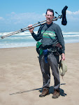
After a good nights sleep, I felt fine, but day #2 started with fog! (I cycled all the way there for dense fog?!) I was on the road with all my cold weather gear (including fleece lined leg warmers and a face warmer - see photo), and could only see about 10 - 20 feet from the road! I did have a lighter bike with only one partly full pannier after leaving food and clothes at the motel. I also did see some Mt. Bluebirds from the road, but few raptors. The sparrows were not moving around much.
At about 9:00, it was clearing and at about 9:30 it was glorious! It warmed up, I peeled off layers, the birds were active, and I could see that the lake (Soda Lake) was full. Sage Sparrows (trip BIGBY #7) lined the path from the turnout near the lake overlook (see my map)and were joined by shrikes, Savannah Sparrows, Meadowlarks and White-crowneds. The Sages ran along the ground with their tails up, like little roadrunners. The lake had a couple hundred avocets wading out in the water. The plain was beautiful for the rest of the day - bright green hills and meadows with splashes of the yellow of early goldfields and pools of water reflecting the clear blue sky. The lush fields and jagged hills of Carrizo Plain contrasted with many rundown homesteads, which had a feeling of isolated desperation with their dead trees, dilapidated buildings and mobile homes, and yards with long-broken washing machines and other machinery, furniture and tires. I stopped at the Goodwin Education Center which had an informative interpretive display on the wildlife and geology, but what happened to the habitat there!?
The ride back north to the motel was birdy and Sage Sparrows were in almost every stand of brush along the road. Occasional Vesper Sparrows (trip BIGBY #8) were in several mixed sparrow flocks along the road - often showing their white outer tails in flight as I pedalled by. A Prairie Falcon (#9)flew from a low pole and away from the road as I cycled the mostly level Soda Lake Road, with a tailwind. The blue of the male Mt. Bluebirds seemed to almost glow in the bright sunlight as I passed a few small flocks. The Carrisa Plains School was alive with birds (e.g Tricolored Blackbirds) feeding on some fruit in the ornamental trees, but the dozen or more collared doves were an unpleasant addition. A flock of over 1,000(!) Long-billed Curlews fed out in a pasture behind the community center, with a few calling out their name as they moved to a new feeding spot. A Merlin took off from a fence post and quickly flew over the plowed field.
This would be a great place to drive and stay at the motel and then break out the bike in mid-morning for a beautiful and easy tour of the plain.
I road an easy 40 miles around the plain and got back to the motel feeling relaxed. I had no cramps in the evening, but I was bored after I cleaned up, took some notes and packed for the next day's ride home. There was no TV and I did not bring a book because of the weight. There was a radio which only has AM reception, with its Spanish-language stations, right-wing talk shows, and born-again broadcasts. I reluctantly threw out much of the unused food that I would likely not use on the ride back - to save weight and got to bed very early.
Day 3 started mostly clear at 6:30, but by 7:30 it was very foggy. I left at about 8:00 and started my ride home with some fear that drivers might not see me in the wet fog. I listen for the sound of tires over bots dots to let me know that approaching vehicles were going around me as there was no bike lane on 58. I had learned not to wear my binoculars on my bike as some pickup truck drivers appeared to pass and then purposely cut back in very close to me when I had the binocs. on my back on the day before.
I saw very little as I approached the hills on the west edge of the plain. As I got into the hills, the fog lifted and I enjoyed the sun, the tailwind, and the junipers dotting the grassy slopes. I heard the birds calling as I cycled past - a towhees "tink", a raven's "croak" and a magpie answered my Gatorade belch with a series of calls sounding like a nasally jay. What a difference a change in direction made from two days prior! I started at an easy pace and enjoyed the ride back to Santa Margarita. I stopped and photographed the fields of Shooting stars at Red Hill Road (see the photo). I heard the short and easily imitable "come here" whistle of Phainopeplas (BIGBY trip bird #10) in three locations between there and milepost 16. They hung out in the large bare valley oaks which had many yellow-green clusters of mistletoe. The yellow blossoms of fiddleneck lined the road in places. I was taking the shortest way back to Santa Margarita and home on 58.
After a good sandwich at the mercantile in Santa Margarita, I headed for Cuesta Grade. The start of the bike path before the 101 summit was not very obvious (just a littered drainage ditch) and the start of the dirt road/bike path at the summit seemed to be unmarked. At first, I saw no other bikes and wondered if I had gone the right way. As I sat fixing a flat, many other cyclists came by. (Good thing I had a patch kit and a spare tube as my new spare tube had a defective valve.) The flat, and a headwind on Los Osos Valley Road, were all I could complain about as I arrived home just before 4 PM, feeling tired but fine. On my next trip I will have a high pressure pump and different brake pads as the ones I had were not very quick to slow me. I may take my SLR and leave the scope, tripod,and point and shoot camera as the digiscoping was slow and cumbersome to set up when I spotted a bird and I missed the capabilities of my SLR.
The trip mileage was about 75 miles out, 40 miles on the plain, and 67 miles back. My bike did well (I used all the gears), I learned some lessons about touring, and I saw 10 new birds for my BIGBY! The Plain really is a beautiful place!