Beautiful white and gray cloud formations surrounded the bare hills as I ascended out of the flat Carrizo Plain into the Temblor Range. The morning sunlight streaked through the cloud cover in spots. I picked up a dazed Horned Lark I saw on the highway and photographed it after I moved it off the pavement. It did not look well; I assumed that it was hit by a car. Western Kingbirds lined the barbed wire fences next to the road, but always flew off before I could get close enough on my bike for a good photo. (This was the most ubiquitous bird on my trip, but I never did get a decent photo of one.) I stopped to photograph a long-abandoned building along the road and wondered about it's history. It certainly had a great view of the Carrizo.


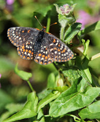
I was trying to figure out the perfect combination of clothes as I climbed - enough to stay warm, but not so much that I got all sweaty. (This seemed to be a frequent challenge when biking hilly areas.) I stopped at two patches of riparian habitat along the highway at San Diego Creek, a small stream that pops out of the hills near Highway 58, and just as suddenly disappears from the surface as it runs down to the plain. I could hear the chatter of orioles and the excited calls of Western Kingbirds. Lawrence's Goldfinches (BIGBY # 241) sang their complex and partly mimic song from the tops of old cottonwoods and Brewer's Sparrows (a desert species I did not expect here, and BIGBY # 242) produced a combination of buzzes and trills from the green hillsides on either side of the road. A lone Black-throated Sparrow (BIGBY # 243), another desert species, also sang from the brushy hill across the road from the creek. Three new year birds in my county, at this one spot, was a good start to the day!
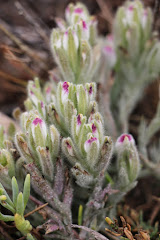
The wildflowers showed up again along the highway starting at San Diego Creek with patches yellow fiddleneck and bluish Phacelia and large slopes covered by some yellow composite. The flowers continued past the 3,258 foot summit (about 1,300 feet above the Carrizo Plain) and descended well into the Great Central Valley. This was a long downhill and I made a mental note that it would be a challenging climb at the end of a long day on the way back! I photographed a white larkspur, which I had not seen before, which grew on the north facing slopes along the road on the Kern County side. The traffic continued to be very light, but the scenery sure changed as I approached McKittrick and oil wells started to appear. I ate lunch at this small oil town that was as sparse as the desert landscape around it. The final descent into the valley floor had the last natural vegetation I would see until I left the valley on the other side - 50 miles to the east. This was a day of extremely contrasting habitats. Unlike driving, I felt, heard, smelled and more fully saw the changes in my surroundings as I went from one type of environment to another.


Large farms were all I would see for the rest of the day, except for a small town or two, until I got to Bakersfield. Huge treeless tracts of wheat, tomatoes, alfalfa, and other crops, punctuated by trees around occasional houses, were a bit monotonous after a while. I looked for Cattle Egrets and hawks to keep from getting bored when I wasn't thinking about approaching traffic.
Finally, after I crossed Interstate 5, I noticed a Buteo soaring over a farm house with dark flight feathers and a dark bib - a Swainson's Hawk (BIGBY # 244). I stopped and took my binoculars and camera out of my handlebar bag. By the time I ID'd the bird and set up my camera, it was flying off and I got a few far off photos like the one here.

It was about this same time that the highway stopped having a shoulder and the ride got scary as large farm trucks and other vehicles had to slow down and (almost stop at times) to get around me. Fortunately for the entire trip, the drivers of big rigs were very observant and considerate and did not come too close. This reduced the danger on the road considerably. I took Highway 43 (just as shoulderless) south to Stockdale Highway, another road which goes east to Bakersfield and it had more room on the side of the road for a bike. Not much else was memorable about the rest of my 76 mile ride to east Bakersfield. I was staying at a standard Motel 6, which was as close as I could stay to the Highway 178 climb up Kern Canyon - the ride many people had warned me about due to the winding narrow road. I had driven it before and knew they were right.
Like most of my trip (except California Valley) I ate and shopped close to the motel where I stayed for the night. In this case I had dinner at Subway and stocked up for breakfast and the next day's snacks at a local supermarket. I learned to blot dry my hand washed cycling clothes in towels before hanging them which helped them to dry by the next morning. It rained again in the evening. I hoped that my luck would hold out as rain was forecast for the next morning. I dozed to the sound of trucks passing on the highway - my fatigue from the day's trip overcame my anxiety over the following day's ride.
I got up at 5:30 on April 29, so I could get an early start up the Kern Canyon (I hoped to beat the traffic)- a climb of a little over 2,000 feet. While looking at the map the night before, I noticed an alternate route for the last 13 miles to Lake Isabella, if Highway 178 was too hairy. After eating a good breakfast of whole wheat french toast and sausages at a nearby sit-down restaurant (Scotties), I didn't get on the road till 6:50 which turned out to be fine as traffic did not get heavier as I rode up the canyon. I stopped at the last gas station before the canyon and picked up lunch - a mediocre pre-made sandwich, chips and chocolate milk at the convenience store.
Once Kern Canyon got narrow, Highway 178 was scary for bicycles as I rode up. The shoulder disappeared, the cars could not always see a bike because of the tight turns and the side of the road was next to granite cliff rising to my immediate right as I pedalled up the highway. Additionally, it started to rain and the wind blew it into my face as I rode toward Lake Isabella. Part way up the canyon, a guy in his thirties who stood by his pickup at a turnoff caught my attention. He asked me if I wanted a ride to the lake as it was an extremely dangerous road for bicycles, especially with the rain. I thanked him for his concern and politely declined. I thought of asking him if he had ever prepared for and then hiked or climbed to a mountain peak, and how he would have reacted if someone had offered him a helicopter ride to the top because it was safer. But, instead, I kept going: not wanting to stop my momentum up. His offer and comments, however, interfered with my attempt to not be obsessed with the fact that my fate was temporarily in the hands of whatever random drivers were coming up the canyon behind me.
Since I was a little cold, I kept pedalling without a break to keep warm till I got to the alternate route, which started about 13 miles up the canyon. At this junction, I did take a brief break for a granola bar snack. There was no traffic at all and the rain was lighter when I got off on this alternate route (Kern Canyon Road), which looked like it was the old highway. This route looked less up and down than the newer Highway 178, which was often in sight. I even heard some birds as the rain let up, such as the whistled call of the Phainopepla and the song of the Blue Grosbeak - like a deep clear version of the House Finch's song but less random sounding. I didn't take any photos on the way up to Lake Isabella due to the rain and not wanting to get cold. I wanted the ride to be over.
I got to the clean and comfortable Lake Isabella Motel, overlooking the lake, at about 11:00 AM. The climb had been mostly gradual and the ride was 42 miles from the east Bakersfield Motel 6 to the Lake Isabella Motel. It was not raining at the lake when I arrived. I ate my lunch in the motel room and decided what I would do for the rest of the day. I rode over to the Main Dam Campground to look for American Dipper as well-known Kern County birder Bob Barnes had told me they were nesting at the dam and also being see at a raft launch just down river. I looked at both spots without any luck (I did have Vaux's Swift). I returned to the motel where I learned from the gregarious owner that my trip into the Greenhorn Mountains planned for the next day was not realistic as it had snowed in the mountains that day and the night before. I went back to my room, napped, and then went again to the dam on my bike for the dipper, where I saw it zip out of the right hand dam structure pictured here and fly downstream right by me (BIGBY # 245).

I returned to my motel room and then went into town to get some wool socks so my feet would not be cold again if it rained, and some gloves since one was missing. This was a favorite pair of gloves and I spent over an hour looking for the missing one at the motel. It was found by the owner later, some distance away from my room, where a cat had likely carried it. I ate dinner at El Portal,a local Mexican restaurant (which was good), did some grocery shopping, and returned to the motel to decide what I would do the next day since the mountains were probably out. I decide to get ready for the morning ride and to call Caltrans in the morning for the condition of the road up into the Greenhorns. This motel room had no refrigerator or microwave, so I was more dependent on nearby restaurants (there were several) than other places I stayed around Lake Isabella.

With bistroMD you will know that not only will you receive delicious entrees, but that every entree and each in bistroMD's weight loss program will be balanced to bistroMD's specific nutritional platform that helps promote an healthy diet.
ReplyDeleteSTEP 1 - Choose one of the diet plans for 5 to 7 days of entrees.
STEP 2 - Take a look at your menu in advance and pick the meals you want for each day and week.
STEP 3 - Order your weight loss program.
STEP 4 - Your entrees are sent to your home.
GET STARTED NOW - delivered to your doorstep.